In local knowledge we trust
What does it really take to bring degraded landscapes back to thriving life? How do field observations and consultations with local communities inform and shape restoration in Uzbekistan? At IUCN, we use tools like the Restoration Opportunities Assessment Methodology (ROAM) to guide restoration at the national level with governments and international partners. But lasting change only happens when local communities, the people who know the land best, are part of the process.

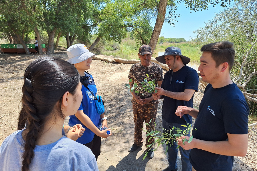
The team of the Ministry of Ecology of Uzbekistan and IUCN, documenting degradation sites and interviewing residents among the mountains of Hisar in Kashkadarya, Uzbekistan
In Uzbekistan, landscapes are as diverse as they could be: arid deserts in Karakalpakstan, Tugay forests along the Amu Darya River, the wetlands and farmland mosaics of Khorezm, and the rugged slopes of the Hisar Mountain Range in Kashkadarya (Qashqadaryo). Each of these regions faces its own environmental pressures. But what unites them is the knowledge and experience of the people who live there, farmers, herders, and protected area managers, who understand daily the challenges of land degradation and the impacts of climate change.
In February and again in June–July 2025, IUCN and the Research Institute of Environment and Nature Conservation Technologies (RIENCT) carried out field visits to communities across the regions. The second mission, which included Kashkadarya, was conducted jointly with experts from the Ministry of Ecology, Environmental Protection and Climate Change of the Republic of Uzbekistan and the Ministry of Agriculture of the Republic of Uzbekistan. These on-the-ground observations offered insights that no satellite image or database could provide.
Local realities of degradation and conflict
The Republic of Karakalpakstan is largely a desert with the remnants of the Aral Sea, with high salinity soil and frequent sandstorms. Here, Tugay forests along the Amu Darya are shrinking under pressure from low river flows, sand encroachment, and illegal logging. Bukhara deer, struggling to find food in the depleted forest, increasingly move into nearby farm fields, consuming crops grown there, to much dissatisfaction of the local farmers. Without solutions this human-wildlife conflict will only deepen as deer populations remain high and food in the forest scarce.

In Khorezm, the challenge is different. This region is a combination of desert, forest, and grassland landscapes. Besides wheat and cotton, farmers here grow melon and gourd, as well as have fish farms in small ponds in the Amu Darya River watershed and near the Khorezm National Nature Park. Bukhara deer are kept largely within the national park, but birds from the wetlands pose a persistent problem for farmers. Flocks descend on fields or fish ponds, forcing residents into a cycle of chasing and culling to protect their livelihoods. At the same time, the intensive push for cotton and wheat cultivation is stretching soil fertility and water supplies thin, leading to hidden forms of degradation that farmers often notice first.
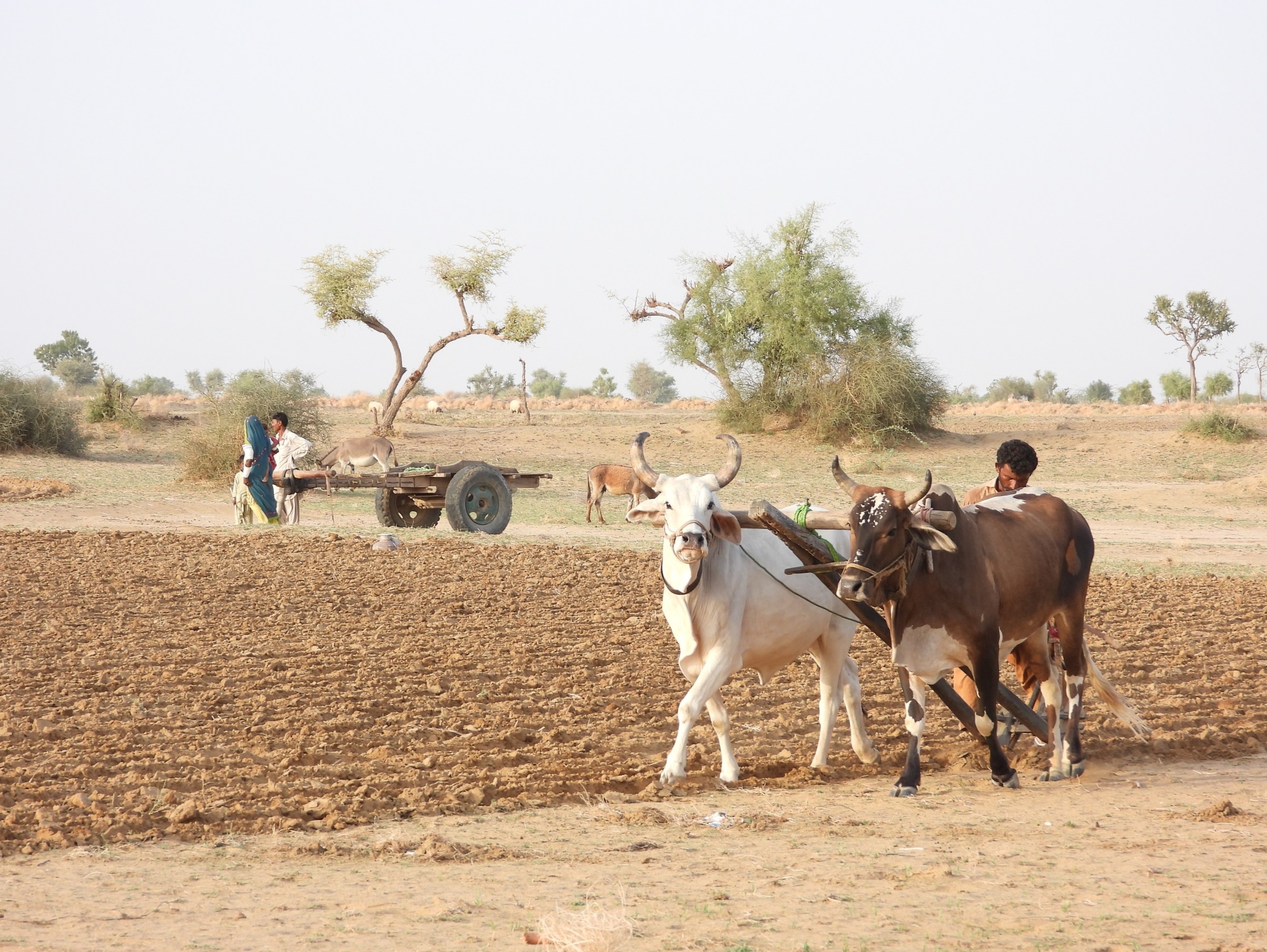
Finally, Kashkadarya covers part of the Hisar Mountain Range within the Pamir-Alay Mountain System. The landscape includes grasslands, shrublands, and forest patches along the range and on the slopes of the mountains. On the mountain slopes, overgrazing, unregulated potato cultivation, and declining water resources degrade the land. Human–wildlife conflict here is more dramatic. Local communities recounted stories of bears breaking into orchards and even entering farmyards at night. While no recent attacks on people have been recorded, the fear is real. Wolves and snow leopards also prey on livestock, creating further economic losses for pastoralists. For many villagers, these conflicts highlight the urgent need for balanced solutions that protect both livelihoods and wildlife.
Learning from the ground
Community consultations revealed not just challenges, but also lessons for designing realistic solutions. For example, in Karakalpakstan, the idea of planting protective “green fences” between forests and farmland looked good on paper, but in practice, the lack of water and maintenance turned the fences into dry, gapped rows of trees that deer easily crossed. The takeaway: restoration must first address fundamental problems like water scarcity and community incentives before advanced measures can succeed.

In Khorezm and Kashkadarya, GIS maps had suggested “moderate degradation.” But in the field, farmers showed us small patches of land degraded so severely by potato monocultures that nothing grew there anymore. These findings shifted our approach, highlighting the need to pair restoration actions with training in sustainable farming practices.
These experiences underline a simple truth: effective restoration is only possible when local communities are fully engaged. Their knowledge fills data gaps, corrects assumptions from desk research, and helps tailor solutions to real-life conditions. Moreover, they are the ones who feel the costs of degradation most acutely and who stand to benefit most from restoration. While national strategies and global programs provide frameworks, it is the knowledge, needs, and priorities of local communities that ensure restoration efforts take root and endure.
Linking local action to national strategy
The fieldwork in Uzbekistan is part of IUCN’s contribution to the Food System, Land Use and Restoration Impact Program in Uzbekistan (FOLUR-Uzbekistan), funded by the Global Environment Facility (GEF) and led nationally by the Food and Agriculture Organization of the United Nations (FAO) with the support of IUCN and the International Center for Agricultural Research in the Dry Areas (ICARDA). Through the FOLUR IP in Uzbekistan project, IUCN supports FAO, the Ministry of Ecology, Environmental Protection and Climate Change of the Republic of Uzbekistan and the Ministry of Agriculture of the Republic of Uzbekistan in restoring 50,000 ha of degraded land and promoting improved management of 300,000 ha of ecosystems, while exploring the potential of introducing Nature-based Solutions as part of the landscape restoration efforts.
To achieve this, IUCN applies the Restoration Opportunities Assessment Methodology (ROAM) in partnership with the Research Institute of Environment and Nature Conservation Technologies (RIENCT). ROAM combines scientific analysis with stakeholder input, ensuring that proposed interventions are not only technically sound but also socially feasible.
The next step will be a third round of fieldwork and regional ROAM validation workshops in autumn 2025, where local communities will co-design action plans for restoration.
Learn more about the Food System, Land Use and Restoration Impact Program in Uzbekistan (FOLUR-Uzbekistan) project (GCP/UZB/010/GFF).
Explore other projects and the work of IUCN in Central Asia
To stay informed, join the IUCN Telegram channel

Disclaimer
Opinions expressed in posts featured on any Crossroads or other blogs are those of the authors and do not necessarily reflect the opinions of IUCN or a consensus of its Member organisations.
In Kashkadarya, Khorezm and the Republic of Karakalpakstan, local communities are helping turn…
The third in a five-part series, this webinar brought together speakers from across West and…

This week, the Yerevan Municipality hosted the inaugural ceremony marking the establishment of the…