Four-day Geographical Information System (GIS) training started at Quetta
A four days Training session started on 12 July 2011 by IUCN Pakistan under its BPSD project at Serena Hotel Quetta.Twenty participants from Government of Balochistan line deparments and Civil Society Organizations are partciipating in the training. Secretary Environmet Government of Balochistan Dr.Saqib Aziz was the chief guest on the occasion.
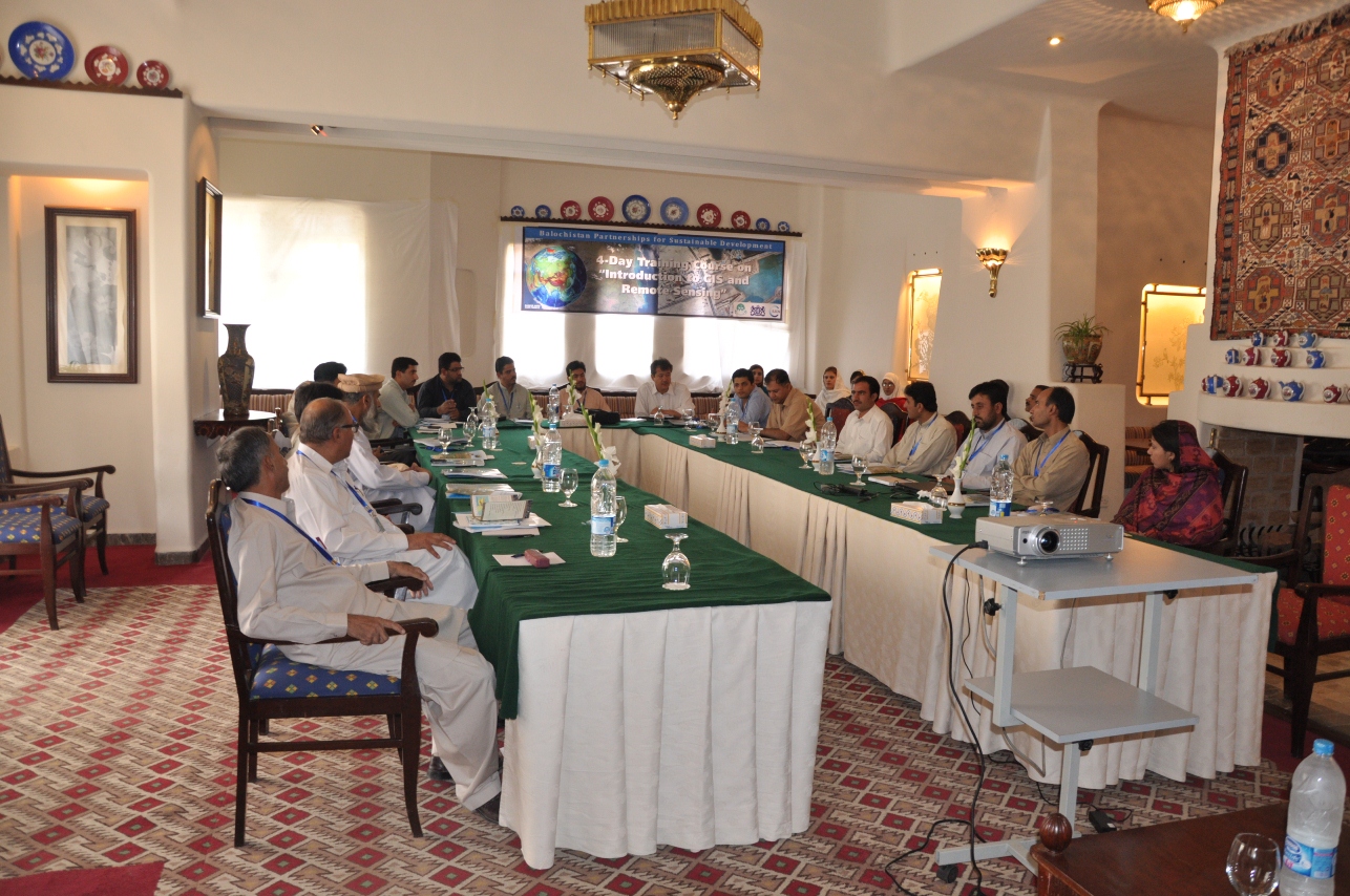
Mr.Zabardast Khan Bangash Manager IUCN Balochistan Programme welcomed the participants and briefed them about the IUCN’s project interventions in Pakistan and specially in Balochistan. He also informed the participants about the benefits of GIS technology, its current uses and future application in the context of Balochistan. He highlighted the following benefits of using GIS technology:
1: Cost savings resulting from greater efficiency. These are associated either with carrying out the mission (i.e., labor savings from automating or improving a workflow) or improvements in the mission itself. These benefits are mostly related to the logistics, routing and managing fleets. He quoted the example of Sears, USA which is implementing GIS based logistics chain in a very cost-effective way.
2. Better decision making. This typically has to do with making better decisions about location. Common examples include real estate site selection, route/corridor selection, zoning, planning, conservation, natural resource extraction, etc. People are beginning to realize that making the correct decision about a location is strategic to the success of an organization.
3. Improved communication. GIS-based maps and visualizations greatly assist in understanding situations. They are a new language that improves communication between different teams, departments, disciplines, professional fields, organizations, and the public.
4. Better geographic information recordkeeping. Many organizations have a primary responsibility of maintaining authoritative records about the status and change of geography (geographic accounting). Cultural geography examples are zoning, population census, land ownership, and administrative boundaries. Physical geography examples include forest inventories, biological inventories, environmental measurements, water flows, and a whole host of geographic accountings. GIS provides a strong framework for managing these types of systems with full transaction support and reporting tools.
5. Managing geographically. In government and many large corporations, GIS is becoming essential to understand what is going on. Senior administrators and executives at the highest levels of government use GIS information products to communicate. These products provide a visual framework for conceptualizing, understanding, and prescribing action. The applications include briefings, land use patterns, crime, environmental hazard mapping and defence/security.
In his opening remarks Secrertry Environment Dr.Saqib Aziz said that before the speech of Mr. Zabardast Khan Bangash I didn’t realize that GIS is so important and useful for us. He said that GIS application is a must in all Government departments like Forest, Agriculture, Education, Irrigation and other Departments. He aknowledged IUCN’s interventions and efforts towards building the capacity of human resource in Balochistan and ensured the support of Environment department to IUCN.
Mr.Ghulam Qadir and Mr. Mumtaz Haider are the facilitators for the training. IUCN will hold three basic and one advanced level GIS training during this year.
For more information or to set up interviews, please contact:
Zabardast Khan Bangash, Manager IUCN Balochistan Programme,
IUCN (International Union for Conservation of Nature)
Quetta Phone: +92 8128240450-2, Fax: +92 812820706
Email: [email protected]

For national governments to better understand plastic waste and leakage, as well as solutions to…
American Humane, the US' first national humane organization and the world’s largest certifier of…
The BIODEV2030 project, launched in early 2020 supports the country's development ambition, while…