Geospatial monitoring and capacity building team to contribute to decision making in the Maya Forest of Belize
The Geospatial Monitoring Unit of the Belize Forest Department (GSMU - FD) has benefited by the Selva Maya Natural Resources Protection project with modern equipment that allows monitoring changes that occur in this forest, as well, it has been strengthened with trainings in the use of acquired technology. This unit works to improve management through applied research, education, improved monitoring and reporting technology that are useful for areas of sustainable forest management, protected areas and wildlife conservation in Belize.
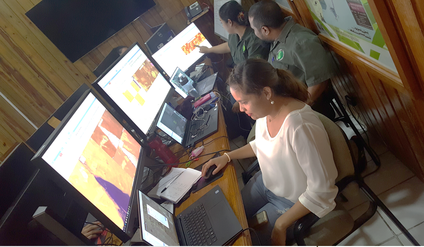
Geospatial Monitoring Unit of the Belize Forest Department – Belmopan, Belize
Photo: © FD / Edgar Correa
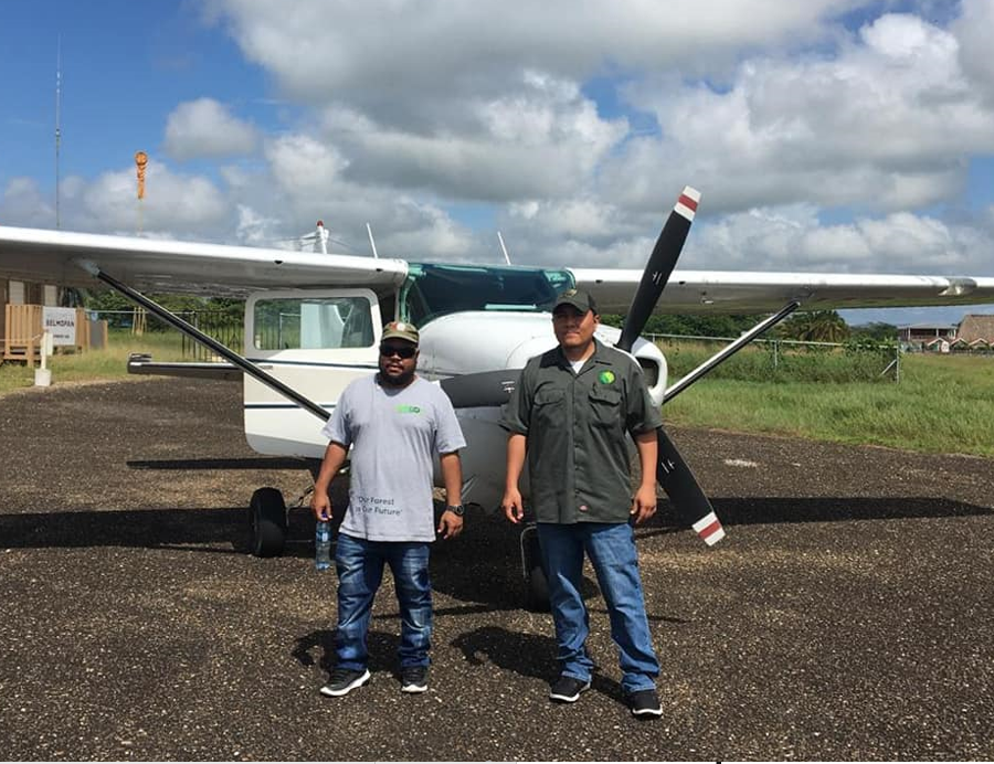
Overflights thanks to the financial support provided through the Selva Maya Natural Resources Protection Project
Photo: © FD / Edgar Correa
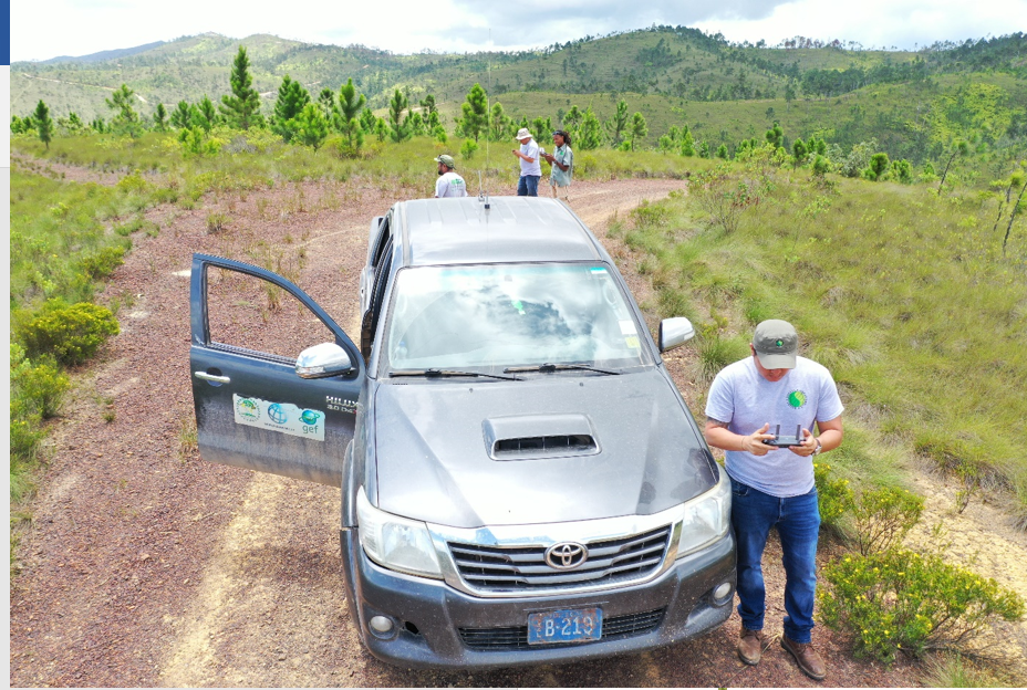
Use of drones for monitoring and surveillance in the Selva Maya – Belize
Photo: © FD / Edgar Correa
Belize, October 8, 2020. The GSMU applies the use of technologies for the effective management and collection of information from different technological equipment from wherever it is necessary, going either to the field or remotely through a screen from the FD offices in Belmopan, Belize. With this, the support of the German Cooperation is reflected in a significant contribution for the efficiency of tasks carried out by the FD at the national level to monitor the sustainable management of the forest resources of the Selva Maya in that country.
Desktop computers, drones, printers, cameras, external units and geospatial monitoring systems (GPS) are part of the acquisitions that have been made with the support of the Project that is part of the Selva Maya Program, which is also implemented in protected areas of said forest massif of Guatemala and Mexico.
“For example, field equipment such as drones are used in forest monitoring (land use change), fire control, pest management and surveillance. Cameras have been used in flybys to collect high-resolution images; computers are used to process high-resolution images and data to produce adequate analytical results, “explains Edgar Correa, who is in charge of the GSMU of the FD.
The acquired technologies are combined with other activities financed by the Project, such as overflights through this tropical forest. Over the last few months, these have been carried out for monitoring and surveillance in key protected areas in Belize; the main objective is to collect high resolution images on land use and land cover using systematic routes specifically designed to capture key areas of interest.
All data collected by the Unit is used to guide decision makers in the development of policies, laws, strategies and plans. Therefore, the objective is contribute to making the Forest Information System (SFI) functional through geospatial monitoring tools and visible forest data, to facilitate all interested parties to implement adequate measures for the conservation of the forests of Belize.
“I would say that the main challenge of not using technology would be the effectiveness and timeliness of data collection. The combination of appropriate capacity building and up-to-date technology improves the effectiveness of the information that is collected and also enables the sustainable growth of the Unit. Therefore, not having the support of this project would not have allowed this unit to improve its skills and be at the level that we are in regards to National Forest Monitoring”, explained Correa.
The GSMU has also received high-level training in drone handling and use, advanced image collection, as well as information classification training. In addition, for a year they have received a certification that covers nine advanced courses on the use of the Geographic Information System at the University of Belize.
It is intended that both the strengthening of capacities and the acquisition of technologies facilitated by the Project are materialized in other tasks entrusted to the GSMU such as the annual estimation of forest loss and change in land use with the use of geospatial technologies, monitoring of forest fires and estimation of impacted areas, updating and digitization of the patrol database, among others.
For more information contact: Adriana González, Communication Officer, [email protected]

For national governments to better understand plastic waste and leakage, as well as solutions to…
American Humane, the US' first national humane organization and the world’s largest certifier of…
The BIODEV2030 project, launched in early 2020 supports the country's development ambition, while…