List of knowledge products produced under the EWMR Project
INTRODUCTION
The Embedding Integrated Water Resource Management in Rwanda (EWMR) Project is a four-year project (May 2019 to June 2023), funded by the Embassy of the Kingdom of Netherlands in Rwanda, with a total funding envelop of app. 24 million Euro.
The overall goal of the project is to improve catchment management contributing to increased resilience of communities and landscapes to the impacts of climate change and other drivers.
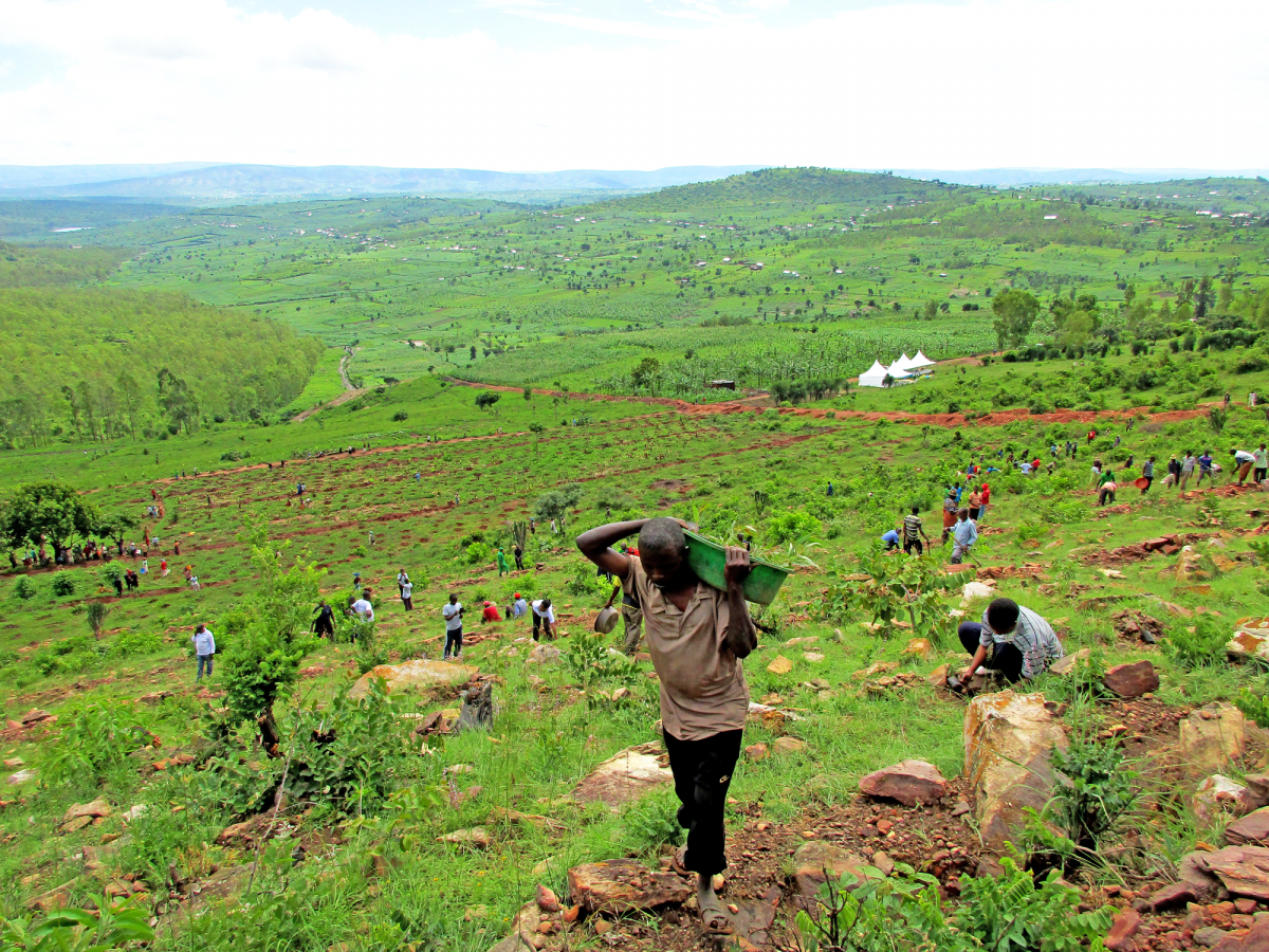
The project focusses on the Sebeya catchment which lies in the Western Province of Rwanda. The Sebeya River originates in the mountains of Rutsiro District along the Congo Nile Divide. The river flows for over 110km and has a catchment area of 286km², spanning the districts of Rutsiro, Ngororero, Nyabihu and Rubavu. The Sebeya River is very important to Western Rwanda, where smallholder farmers use this river for irrigation, a source of drinking water for many households, and hydroelectric power.
For the past twenty years, hundreds of people in the Western Province including in Sebeya catchment have been displaced and communities negatively impacted by Sebeya River floods, a result of poor agriculture practices, deforestation and unsustainable mining practices, among other causes, and driven by a high population density (500+/km2) and poverty.
In order to attain healthy and productive environments, a landscape approach, which identifies and builds on the inter-dependencies between landscape status, ecosystem service supply, agricultural production, governance, and human wellbeing, is required.
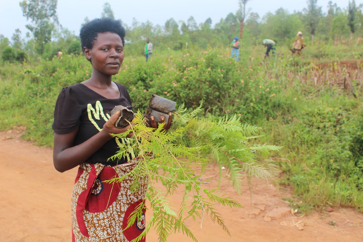
In this regard, the EWMR is a holistically integrated program, founded on a community participatory-based approach, relying on participation of the local communities in Sebeya catchment in planning, and implementation of catchment restoration activities.
It is built around 4 work packages that target to:
- Reduce land and soil degradation, river sedimentation and flooding.
- Improve incomes and resilience based on sustainable use of landscape resources.
- Empower landscape governance and management institutions.
- Provide evidence-based guidelines for the landscape approach
In addition to a focus on the Sebeya catchment, the project also has national components (studies and capacity building), and will support the development of Catchment Plans for 4 other Level 1 catchments, i.e. Akanyaru, Mukungwa, Lake Kivu and Akagera Lower.
The project is implemented by the Rwanda Water Resources Board (RWB) with technical assistance from International Union for Conservation of Nature (IUCN), and its consortium partners, the Netherlands Development Organisation (SNV), and Rwanda Rural Rehabilitation Initiative (RWARRI).
KNOWLEDGE PRODUCTS
A key part of the project is to generate knowledge products from studies, research, assessments and, most importantly, action on the ground, bringing lessons to scale and use lessons and knowledge for policy influence at district and national levels, but also internationally.
Below lists and provides a brief description of various knowledge products that have been produced as part of the project. If you wish to receive the full reports or guidelines, please feel most welcome to send an email to rwanda@iucn.org and we will be happy to share with you the requested document(s).
- A biophysical and socio-economic and baseline assessment for landscape restoration and Integrated Water Resources Management in Sebeya Catchment
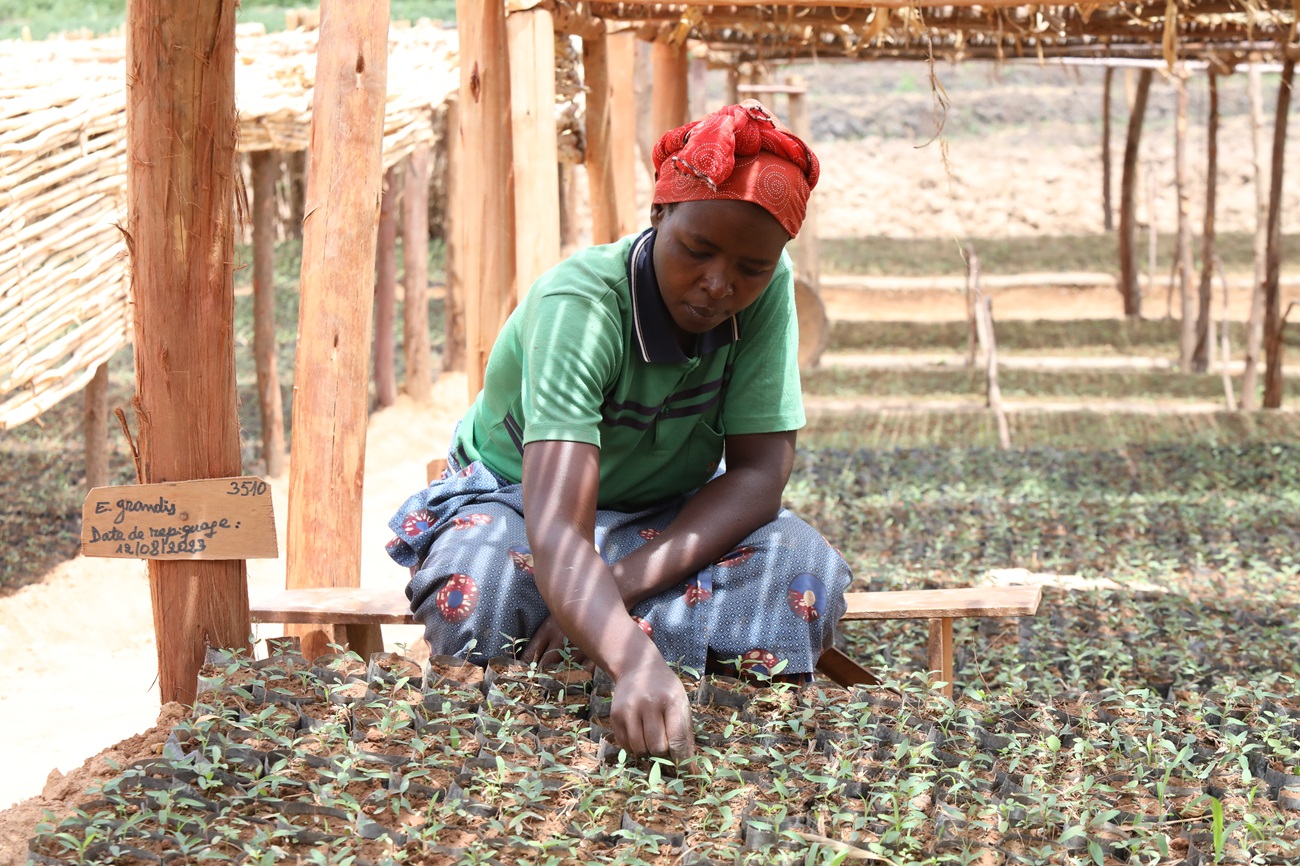
The project baseline study was conducted in 2019 at the start of the EWMR Project. It entailed literature reviews, data mining, modelling, field studies, household questionnaires, monitoring and measurements, SWOT analyses, expert interviews and focussed group discussions.
- Final report on livestock analysis in Sebeya
This study was conducted to assess the livestock ownership and preferences of households in Sebeya catchment. It assess livestock ownership, farmers’ preferences and suitability of livestock types to a specific agro-ecological system and propose appropriate interventions that are good for livestock husbandry. Further it proposes an a model for handing over animals to beneficiaries, potential and reliable source of livestock species, cost estimates, and methodology for issuing appropriate type of livestock that will foster ownership among beneficiaries.
- Community Approach Guidelines
The Community Approach Guidelines are based on the successful experiences of EWMR Project in achieving sustainable and positive community led landscape restoration and Integrated Water Resources Management outcomes. The guidelines can be used by communities, national, district and local governments, Non-Governmental Organizations, Community-Based Organizations and other key stakeholders, and are available in English and in Kinyarwanda.
- Guidelines for Village Land Use Action Planning (VLUAP) and Learning
These guidelines complement the Community Approach Guidelines and describe in detail the process of engaging communities in the development of their own Village Land-Use Action Plans. Through this process communities are firmly in the driving seat of identifying, prioritizing and subsequently implementing landscape restoration interventions in their communities.
- Village Land-Use Action Plans
200 Village Land-Use Action Plans (VLUAPs) have been developed under the EWMR Project. Each VLUAP describes the context, the village, main land-use related challenges, prioritized interventions to address those challenges (the Problem Tree Analysis: issues/problems, causes, effects, and proposed solutions), costing, and action plan.
- A guide on how to construct Progressive Terraces
Progressive terraces, soil bunds, ditches, and Radical Terraces are physical soil conservation measures for landscape restoration and protection. The overall purpose of these soil conservation measures is to slow or prevent the rapid surface runoff of rainwater, through breaking landscape slope. This guide describes how progressive terraces should be designed, constructed and maintained.
- Comparative rapid assessment of costs and benefits: with and without radical terraces under EWMR project
This study assesses through a rapid before-and-after assessment of the costs, agricultural yields, and associated benefits of radical terracing in Rubavu and Rutsiro Districts in the Sebeya catchment.
- Rapid Assessment of Rainwater Harvesting (RWH) Systems applicable to Households, Schools and Health Facilities in the Sebeya Catchment
This report presents a general overview of different rainwater harvesting systems practices to households, schools, and health facilities in Rwanda and how it can be applied for different households and institutions in the Sebeya catchment. This includes technical designs, materials required and their cost estimates, and recommendations on criteria for the most effective and context-appropriate rainwater harvesting system in the study area.
- Community Environment Conservation Fund (CECF) schemes in Sebeya Catchment - Piloting a Community finance mechanism to promote landscape restoration and supporting livelihoods
As part of the innovative finance mechanisms to support landscape restoration, the EWMR project piloted the Community Environment Conservation Fund (CECF). The CECF works by providing seed money for establishing a local community credit fund that communities, through the established Village Saving and Loan Associations, use to implement activities that target restoring and managing ecosystems, usually based on an agreed-upon environmental management plan. This concept note describes the approach used to roll out the CECF in the Sebeya Catchment.
- The State of Soil Erosion Control in Rwanda
Soil erosion is the most serious environmental problem in many catchments areas in Rwanda. The main factors affecting the amount of soil eroded include land use and vegetation cover, topography, soil and climate. This report analyse the erosion risk in 30 districts in Rwanda and presents for each 5 thematic maps: 1) erosion risk distribution, 2) erosive features currently in place, 3) land use and vegetation cover in high erosion risk areas, 4) existing erosion control techniques and 5) recommended erosion control practices in the view of unprotected land located at erosion risk. The data provided in this report serves as a benchmark for enhanced planning, implementing and monitoring of erosion and erosion control measures.
- A Mining Situation Analysis in Sebeya Catchment - Identifying How Mining Can Contribute to the Sustainable Integrated Water Resources Management (IWRM) In the Sebeya Catchment
Rwanda is rich in 3T minerals (tungsten, tin, and tantalum). These minerals are very important for overall Rwandan exports because of the heightened demand for them in global markets. Mineral mining in Rwanda is conducted mainly as artisanal and small-scale mining (ASM). This study documents the mine operators, mining practices, the mining methods used in the Sebeya Catchment, and its associated environmental challenges. The study also recommends a numbers of actions that need to be implemented at the policy, catchment and the district levels to reduce negative impacts resulting from mining.
- Assessing the contribution of mining to sediment loads in the Upper Nyabarongo Catchment
This study assesse the contribution of mining to sediment loads in the Upper Nyabarongo Catchment, with focus on the Secoko sub-catchment. It consisted of assessing the spatial and temporal variability of water quality in the streams of the sub-catchment; assessing contribution of mining to sediment load by using the fingerprinting methodology. The results showed that the concentration of Iron, Manganese, Magnesium, Copper, Arsenic, Antimony, Tin, Cadmium, Cobalt, Tantalum and Lead exceeded the acceptable values for surface water quality compared to RSB standards. The high values observed of metallic elements could be attributed to land use activities within the catchment.
- Rapid Technical Assessment of Medium Size Gullies Rehabilitation/Treatment in Nyabihu and Rubavu Districts
This report presents a first rapid technical assessment of medium size erosion gullies in Rubavu and Nyabihu Districts that result from landscape degradation in the catchment, and that urgently needed to be rehabilitated. The report presents proposed gully treatment measures, technical specifications, and their costing. The report was used to inform the project’s 2020-2021 budgeting.
- Technical Assessment and Designs for Rehabilitation of Larger Gullies in Sebeya Catchment
The Sebeya River plays a major role in hydropower production, and water provision to the catchment’s inhabitants and animals. Hydropower and drinking water intake often need to shut down during periods of heavy rain which results in extreme sediment loading. Those sediments are mainly transported into the river through various gullies scattered within the catchment and whose sizes increase overtime at the point where some of them have become a serious threat to the surrounding communities. This study assesses and proposes measures for the rehabilitation of the largest gullies, and proposes measures to reduce run-off in the catchment from grasslands, radical terraces, settlement areas, and poorly designed roads.
- Scoping study on green roads for water opportunities in Sebeya Catchment – integrating climate change adaptation and water management in design, construction and rehabilitation of roads
This study assesses the current issues on roads and the surrounding of the roads landscape in Sebeya catchment, explores the potential for Green Roads for Water in Sebeya, provides recommendations for Green Roads for Water interventions in Sebeya, prepares a plan for implementing Green Roads for Water on a pilot feeder road, and presents a wide variety of recommended Green Roads for Water interventions.
- Sebeya Catchment Payments for Ecosystem Services: Gap Analysis
In recent years, various stakeholders in Rwanda have carried out a number of high-level scoping studies to inform the design of a Payments for Ecosystem Services Scheme in Rwanda. However, in order to inform the further design of pilot PES contracts and projects in the Sebeya catchment, it was necessary to understand (i) what choices and decisions have already been made, what decisions remain to be made, and what further information is needed to inform decision-making. This Gap Analysis report” reviews available project documentation to (i) inform project management about what choices have already been taken in respect of PES contract and project design, and (ii) identify the gaps that need to be addressed.
- Rwanda Water Resources Atlas
The Water Resources Atlas presents information on water resources of Rwanda, its spatial and temporal distribution, and uses. The Atlas makes extensive use of illustrations to present facts, characteristics, and trends with respect to the water resources and serves as a shared knowledge on water resources management in Rwanda. It is designed to provide comprehensive and current water resources data for the country and to promote evidence-based and knowledge-supported decision-making by citizens, scientists, civic and private section, and national planners.
- Bio-Physical Assessment and Hydrological Analysis for Akagera Lower catchment in Rwanda
This study was conducted as input to the Akagera Lower Catchment Plan development. It explores and analyses land use and land cover, hydrological assessment, future water availability scenarios, mapping existing and future water uses, water allocation modelling, scenarios for allocation and reservoir releases, lake active storage assessment, capacity building, and management and reporting.
- Bio-Physical Assessment and Hydrological Analysis for Mukungwa catchment in Rwanda
This study was conducted as input to the Mukungwa Catchment Plan development. It explores and analyses land use and land cover, hydrological assessment, future water availability scenarios, mapping existing and future water uses, water allocation modelling, scenarios for allocation and reservoir releases, lake active storage assessment, capacity building, and management and reporting.
- Socio-economic and Livelihoods Assessment in Akagera Lower Catchment, Rwanda
This study was conducted as input to the Akagera Lower Catchment Plan development. It explores and analyses current status of socio-economic and livelihoods conditions of communities living in the Akagera Lower Catchment. The study further provides and analysis on the economic and financial benefits through Cost-Benefit Analysis (CBA) of landscape restoration options, livelihoods opportunities, interventions and key stakeholders.
- Socio-economic and Livelihoods Assessment in Mukungwa Catchment, Rwanda
This study was conducted as input to the Mukungwa Catchment Plan development. It explores and analyses current status of socio-economic and livelihoods conditions of communities living in the Mukungwa Catchment. The study further provides and analysis on the economic and financial benefits through Cost-Benefit Analysis (CBA) of landscape restoration options, livelihoods opportunities, interventions and key stakeholders.
- Various technical and training materials on village savings and loan associations, land husbandry, soil management practices, strawberry cultivation, potato cultivation, compost making, biological ‘push-and-pull’ pest control, livestock husbandry, improved cooking stoves, and rain water harvesting tanks.
- For the following documents developed under the EWMR Project, please contact RWB:
- Rwanda Water Resources Board (RWB) Strategic Plan 2021-2030
- The final Akagera Lower, Mukungwa, Kivu and Akanyaru Catchment Plans
- The Environmental and Social Impact Assessments (ESIAs) of Flood Protection Structures
- Resettlement Policy Frameworks (RPFs) for Flood Protection Structures
In partnership with

With financial support from

Disclaimer
Opinions expressed in posts featured on any Crossroads or other blogs and in related comments are those of the authors and do not necessarily reflect the opinions of IUCN or a consensus of its Member organisations.
IUCN moderates comments and reserves the right to remove posts that are deemed inappropriate, commercial in nature or unrelated to blog posts.
Related content
Rwanda is the Land of a Thousand Hills, but are these hills still healthy and productive? This is...
Rwanda is ranked among African countries in terms of natural resource dependency. In recent years,...
Forest landscape restoration is about restoring the ecological and productive functions of degraded...

Suscríbase a un boletín de la UICN.