The project aims to carry out spatial and field studies on vegetation cover to identify the carrying capacity as well as identify suitable grazing systems on 10 grazing sites namely; ALQasseim, Hael, AL-Madinah, Mekka, Asser, Najran, Joof, Eastern area, Northern borders, and Jazan). The estimating of the carrying capacity project implements by Tilad for environmental consultancy company with the supervision of the IUCN’s regional office for West Asia. The project is expected to be completed over two and half years (30 months, starting 01st January 2023, and ending 30th June 2023).
Main deliverables:
- Implementation of seasonal satellite and field-based studies for the characteristics of vegetation cover, data analysis, and estimation of pastoral load.
- Determining and defining each site's grazing system and pastoral cycle.
- Implementation of workshops, training courses, and field days in the field of vegetation cover assessment and estimation and the pastoral load at the target sites.
- Support in preparing and producing maps preparing geographical databases for the pastoral load and appropriate grazing systems.
- Determine the number of animal units appropriate for each site.
Restoration of degraded rangelands and rainwater harvesting in the Kingdom of Saudi Arabia.
Project implemented and executed by: Tilad for Environmental Consultancy & The International Union for Conservation of Nature (IUCN).
Project Funded By: The National Center for Vegetation Development and Combat of Desertification (NCVC)-Kingdom of Saudi Arabia.
Key achievements:
- Produce digital maps for all targeted sites (26 sites). The digital maps include for instance the following maps:
- Digital Elevation Model (DEM) with a 30 m spatial resolution derived from the SRTM platform, as well as slope, aspect, hillside, and roughness maps.
- Land Cover map in accordance with Land Cover and Classification System (FAO) derived from the MODIS platform with a 5 km spatial resolution.
- Day and night average temperature derived from the MODIS platform with a 1 km spatial resolution from 2015-2023.
- Average rainfall derived from the CHIRPS platform from 2018-2023.
- Digital maps illustrate vegetation indices such as (normalized difference vegetation index (NDVI), Green Normalized Vegetation Index (GNDVI), Enhanced Vegetation Index (EVI), and Moisture Stress Index (MSI).
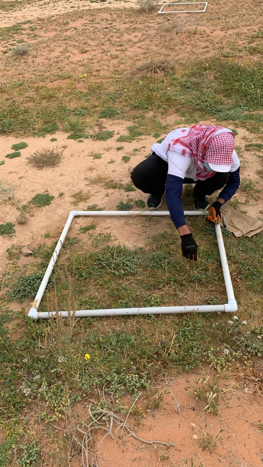
- Field survey for three grazing sites namely; ALQasseim, Hael, and ALMadinah grazing site. The surveys aim to determine plant checklists, key plant communities, species composition, species density, and species frequency).
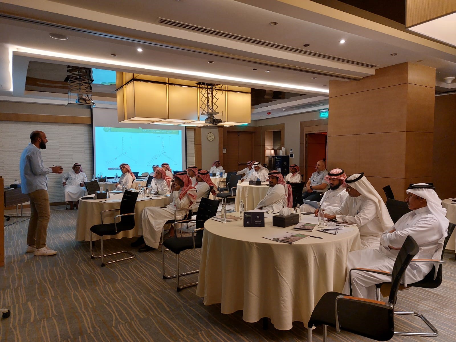
- Organize training workshop on plant survey and water harvesting from 07-10th May 2023. Almost 22 participants from the national center for vegetation development and combat desertification have joined the training.